Clearance
20th April 2024This year, the Easter period for me has been filled with decluttering of my house and reorganisation of what is inside of it. In part may have been encouraged by the mixed weather that we have been getting for much of the last twelve months, let alone the last few weeks. There appears to be no real break coming on that front, so it was just as well that I took a chance on a mid-Wales trip at the start of March.
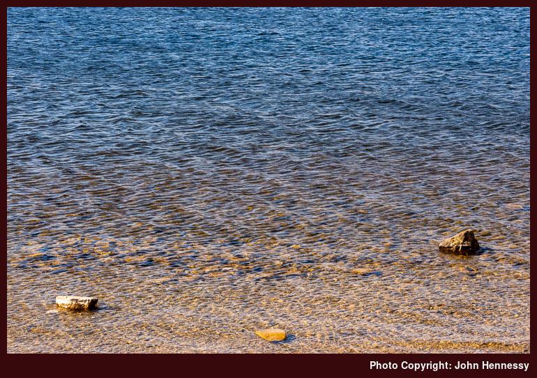
That did have some sunshine at times, which is what tempted me to base myself in Aberystwyth for a few days. The first full day allowed for coastal ambling, firstly around Aberystwyth itself (taking in Penparcau) and then south along the coast as I walked back from Borth.
The next day saw me head inland for a hike that took in Pumlumon Fawr and Bwlch Nant-yr-Aran. The wind was not only cold but also brutal in strength, so I did not dally on the tops. It was only dogged determination or perhaps foolish stubbornness that propelled me to the top of Pumlumon Fawr in the conditions.
The air had been clearer with some sunshine to brighten my surroundings, somewhat justifying the exertion of willpower. On the way back from Ponterwyd, the bus driver was wondering what I was doing out and about on such a cold day, only to laugh when I told him that the real problem was the strength of the wind. The skies were greyer as I started my return home, yet I was not disappointed with what I had got.
Since then, there has been a broadband upgrade in advance of all the domestic alterations that I have been making. Charity shops have been beneficiaries of all this clearance, and the restrictions on bin capacity meant that getting rid of any waste proved challenging without access to a car. The added clearance makes all the effort worthwhile, though. Some new pieces of furniture have replaced old ones too, and a spot of painting brightened some walls in its own way. While progress has been good, there is more to do.
That may wait, though, since my mind is turning to excursions should weather windows offer. A walk on Ben Ledi near Callander is a tempting idea, as is a brief visit to Paris that uses rail travel to get there and back. Other French destinations may be later possibilities, like North American escapades to Portland in Oregon or Seattle in Washington State.
More photos of North America
21st March 2024
The North America section of the photo gallery now looks a little more substantial after adding an album for photos from last year’s trip to the San Francisco Bay Area. There already was one for those from 2019’s trip to British Columbia, and that looked a bit lonely on its own. It is not so easy to claim an interest in exploring another continent with only one substantive visit having happened.
While my appetite for North American explorations has been sated somewhat by those two trips, I cannot rule out the possibility of there being another this year. Seattle and Washington State both look tempting. A visit to Olympic National Park could be a possibility. However, as I know from my designs on Denver and Boulder in Colorado for the summer of 2020, anything could happen that stymies such schemes. Nothing has been planned yet, since I have a few things on my plate at the moment.
Something for muddy going
12th March 2024The amount of rain that has beset our lives since last summer has made some places so muddy that I am contenting myself with wellington boots on local walks. They are not the most comfortable, but they deal with the surface water and the greasy conditions underfoot.
These are not the times for crossing fields and the like with footwear that you might like to keep in a respectable state. Aside from formal wear, this also includes anything that I might use for hiking overseas. Meindl boots are the mainstay there, so I also have a pair of Scarpa Ranger II Activ GTX boots that I do not mind covering with mud.
In the autumn of 2022, these replaced a pair of Berghaus boots that frankly were too big for me and even hurt my feet enough for their becoming a charity shop donation. The Scarpa boots fit better, though going a European size down might not do any harm either. So far, even they have gone overseas, even if that might change if they start to look too muddy.
Thus far, the Scarpas have been all around Great Britain as well as Ireland, the Channel Islands and France. Aside from a trip beside Loch Morlich, their size has done no harm and certainly has not caused any foot injury. Thus, I am sticky with these. It might be useful to have older boots like my now retired Meindl Bhutan pair (after losing a sole, repair was unrealistic given how battered the uppers looked) for muddy walking, but these will do for now.
It helps to have good maps…
1st March 2024While writing trip reports for Tenerife, I was reminded of the travails that I encountered with using the maps that I had in my possession. At the time, I found myself cross-referencing data between different providers for working out where I was going. That was not ideal, but I managed to make it work.
Something similar happened in Canada. When the maps from Natural Resources Canada did not have all the detail that I expected, I resorted to using the base map provided by ViewRanger because it showed trails on there. For my various traipsings, that did suffice, even if there are possible risks like those highlighted in an article on the TGO website.
In the UK or Ireland, it may be that the tracks shown cannot be used by the public, so you need to check how things look on the ground. Then, there are possible errors because many trails are crowdsourced. That is another reason for checking on what surrounds you and applies when using user routes found on various apps and websites. The likes of AllTrails and Outdooractive come to mind here.
In my case, I ran into no problems in Canada because I was following low-level trails and established tracks much of the time. For off-trail use, mapping from National Resources Canada would have proved as necessary as the use of a compass and awareness of wildlife. Hiking in North America takes one into wilder places after all. Finding paper maps takes a bit more work, as I found, but the added effort pays dividends as long as you watch coverage of where you are planning to go.
In a more recent excursion to California, the Gaia GPS app became invaluable as long as I had downloaded the map data before setting off on hiking trips. Topo Maps+ from Glacier Peak Studios may be another option for users of Apple devices, but I stuck with what I had courtesy of a subscription to Outside+. In any case, Gaia GPS did whatever I needed, and I hardly needed to check any paper maps that I had.
That was just as well, since map scales vary widely for U.S. hiking areas anyway. USGS quads may be standardised, but the same cannot be said for other publishers, with National Geographic being a prominent example. Still, any device has a limited battery lifetime so being proficient with a map and compass remains a necessity, especially in remote areas where mobile signal may be too limited.
Slaughter
29th February 2024Network Rail has been busy cutting down trees beside the Macclesfield stretch of the West Coast Mainline. The result is not pretty and affects a nearby walking route that I often use. Tree trunks have been denuded and left to look lifeless. If life restarts on these, the devastation may be softened, but that is not within sight just yet.
While I can understand that windthrow is a problem for trees next to a railway line during stormy weather, the aftermath of the cutting looked sad to my eyes. Shelter was removed, and it may be that walkers do not need such a clear view of the railway anyway. It all caused a trail that has something of a bucolic aspect to appear more industrial than it used to do.
The time of year hardly helps, with all the leafless trees and bare ground after the winter. Maybe things will look less brutal during the coming growing season. For now, though, there is a lot of carnage that needs healing. At times, I have had my misgivings about tree cover when seeking photos of scenic spots, yet that is not how I feel about this ongoing aftermath.