2012, before an advancing life storm
31st December 2013For various reasons, this summary of my walking during 2012 is arriving twelve months late. That’s mainly because I was not in the right frame of mind for writing it this time last year. The subsequent year has been life changing yet wandering through countryside not only did not stop but its restorative effects never were more needed. Before that though, things felt more steady and here is how things went.
January saw me staying local with a three counties (Cheshire, Derbyshire & Staffordshire) stride between the Cat and Fiddle Inn and Buxton that took in the Three Shire Heads bridge. It was having extra time on the day that allowed that to happen even if I arrived at Grinlow Tower, or Solomon’s Temple, too late in the day for much in the way of photography. Even now, I have yet to be there on an occasion when the conditions allowed for the sort of photographs that I like to savour and there were two visits during 2013. Some things take time to happen so patience is a prerequisite.
There no such constraints when I walked from Alnmouth train station to Embleton by way of Northumberland’s pleasing North Sea coastline and the remains of Dunstanburgh Castle, now under the care of English Heritage. What I got to experience was the sort of crisp sunny day that adds so much to a walk. That was much more than a previous walk in the same area more than six years before.
March was a quiet month on the walking front because of heavy work commitments and April was little better even if I was not working as hard. Even so, I did to walk up Nab Head near Bollington as an addition to a cycle that circled around by Pott Shrigley. Even with a heavy cold towards its end, May worked out much better with an evening spent around Tatton Park and other spots in Knutsford. The next day saw me get as far as Waterhouses in Staffordshire to fulfil and often aborted scheme: following the Manifold Trail from there to Hulme End. When that turned out to take less time than expected, I extended the walk to take in both Wolfscote Dale and Biggin Dale to finish up in Hartington. That was another design fulfilled on a day when sub eventually beat cloud cover to deliver its delights to anyone out and about. Later in May, I returned to Northumberland to visit Alnwick and Warkworth to see their castles.. The day was a hot one so it was best to limit exertions and a previous heavy cold made that all the better as a plan. There were enough sights to savour anyway and, with views along the Aln and the Coquet available so easily, there was little need to rush along anyway.
The extended public holiday weekend at the start of June, the bank holiday was moved from its usual place at the end of May, offered an opportunity for a getaway and I struck lucky in Scotland’s Eastern Highlands. Having based myself in Pitlochry, I took in the shores of Loch Ericht and sampled a little of the scenic drama of Glen Tilt. Sun was in short supply at times and it limited what I could do when capturing a view of Blair Castle. Even that was better than the wetting that anyone attending the Diamond Jubilee Events in London when rain that was very typical of the year pervaded. Just like a previous trip to Pitlochry nearly six years earlier, my walks were mere tasters and I was more than happy with that at the time, unlike that preceding visit that left me yearning for more.
Having had it in my head for a while, I finally got to do an evening walk from Wilmslow to home after work during June, mostly using the route of the Bollin Valley Way except for where bank erosion necessitated an untidy diversion. It should have been a matter of reversing a previous walk along the route done of a winter afternoon whose timing mostly is lost to memory unless digital photos offer some resuscitation.
Even with 2012’s reputation for wet weather, I still got some other pickings from its summer and limitations on sunshine were a marked feature of otherwise dry weather walks. Looking on the positive side, it may have been better than walking in sultry heat. One outing in such conditions happened in July with a visit to Sedbergh from where I walked as far as The Calf in the Howgill Fells. That out and back trek definitely was satisfying and left me open to more like it. That I tasted my best ever fish and chip supper added to the appeal. Maybe I should go there again and there’s more of Cumbria and Yorkshire to be explored or revisited as well.
August saw me head to Wales twice. First, it was to the Gower where I walked over Rhossili Common before picking up the coastal path from Rhossili to Port-Eynon by way of Worm’s Head. The walk was a glorious one even with cloud advancing from the west all the while. Also, I’d like to revisit the portion near Port-Eynon because it looked very primeval and I was passing it with the object of catching a bus on my mind. As it happened, roads around the Gower were chaotic and the bus that I was making nearly was two hours late as a result. Still, I got back to Swansea for the night before light failed and electrical rain storms made landfall.
The Summer Bank Holiday weekend allowed time for a trip to Pembrokeshire, again revisiting somewhere not sampled since 2006. Only the Sunday of the weekend offered much in the way of dry weather and there even were showers in the evening time. Before then, I got in a walk from Strumble Head all the way to Fishguard under ever cloudier skies. The day started well so I saw Strumble Head at its best and very nearly got lured south-west instead of following the planned eastbound course. It was completed in dry weather so there were no complaints, especially with the drenching that came the next day.
The second weekend of September granted us a glimpse of how the summer of 2012 might have been and I popped over the county boundary into Derbyshire for a stroll by the River Dove that took me from Thorpe to Hartington. The southern end of Dovedale was mobbed with families and I couldn’t get into my stride as I would have liked but things were so much quieter north of Milldale that there was no such concern. What took over as I neared Hartington was how hot the day felt in the afternoon sun after I had emerged from Wolfscote Dale. Any thoughts of an extension as far as Longnor or Crowdicote were set aside in favour of returning home. Quite how those wearing suits during the well dressing ceremony stuck their attire in the heat is beyond me. Maybe I am more warm blooded than some…
September ended with another sunny interlude and that drew me along the Saddle of Kerridge and onto Tegg’s Nose before I turned for home in the fading light. Ambitions for a trip to Teesdale in County Durham were frustrated by fatigue so the more local yomp was what was needed. Indeed, it made me ask why I didn’t head out among nearby hills more often than I did. Local walking has set that to rights though a Teesdale incursion has yet to happen.
The first Sunday in October allowed a trot along the Goyt Valley that had lain in my mind for a while. On the day, so many walking possibilities came to mind that I had difficulty choosing between them. There was walking home from the Cat and Fiddle Inn to take in Shutlingsloe along the way. Trotting along the Gritstone Way between Bollington and Disley was another though a late start put paid to that option; it was to serve me well later. The sight of cloud advancing from the south decided me at the Cat and Fiddle Inn so I headed for the Goyt Valley and it wasn’t a bad choice at all. The ground conditions were well soggy after all the rain that had fallen during the preceding six months and that was expected. Autumn and winter walks bring with them encounters with mud so that was no irritation and I had sunshine as far as the dam of Errwood Reservoir. Cloud took over then and the shore of Fernilee Reservoir was shadowed under overcast skies. Since I quite fancy retracing these steps with some sun, that is another excuse for a return sometime. When Whaley Bridge was reached, there was no dissatisfaction and it had been great to clear my mind.
November saw me make two trips to Tatton Park near Knutsford after some photos of autumn colour. The first of these involved some foolish conduct on my part and what I got for my pains was a ripped jacket, soggy feet and clouding skies that thwarted my hopes. The second outing set things to rights and all was unperturbed again. It was in that spirit that I made use of a possibility left unused the month before: following the Gritstone Trail from Bollington to Disley with a visit to Lyme Park. The morning was glorious and clouds left the sun alone until I had got as far as Sponds Hill. Much was savoured before them and it was my first sighting of sunlit Derbyshire hills from there. It was with satisfaction that I dropped into Lyme Park and ambled unhurried from there into Disley. There was one final trot before November was done: along the Macclesfield to Congleton along the banks of the local canal. The section between the Bosley locks and Buglawton was a delight even under cloudy skies and with declining light. Though I repeated the trek in the opposite direction, it remains worth revisiting.
December brought more fraught prospects and Christmas week was a difficult one for our family. Worries about my parents’ health pervaded and there were much needed short walks taken for head clearance. One of these took me over to Tatton Park again and the winter sunlight did nothing to disappoint, if only I wasn’t feeling so raw inside. 2013 then looked a tall order yet I made it through the year. At the point, 2014 looks less foreboding and it will be taken one day at a time. Life is not for grand designs right but smaller ones will do just fine. Hopefully, your 2014 will bring you good things and I am happy to await what it brings me.
Back to Pembrokeshire
2nd January 2013When I first visited Pembrokeshire on the first weekend in June 2006, I had no idea that it would take more than six years to get back there again. Then, I only had been a month blogging and the terseness of the description of my weekend down there reflects this. Nowadays, my description of the ups and downs encountered between Newgale and St. David’s would merit more than a little mention, though perusing the photos from that sunny summer weekend do keep my memories of how steep the drops and rises were very much alive. Similarly, the article that inspired me to go on that first trip still hasn’t faded from my mind’s eye either and I might just go looking through past issues of TGO to revisit it again.
Though I only had a long weekend, I got in more than just one stretch of Pembrokeshire’s coastline and its national trail. Sunday saw me take in a circular walk around Marloes with even more rugged cliffs to be savoured. Monday may have been when I went home again, but that didn’t preclude a little nibble of what lay around Newport, both the coastline and the Mynydd Preseli hills. It was but a short stop while on route to Ceredigion but it was memorable nonetheless.
My route home saw me continue to Aberystwyth by bus before going by rail the rest of the way. That had me playing with going to see more of Pembrokeshire by reversing the route to make more again of another possible weekend stay that never came to pass. It might have been the way that I’d have gone last August but it never entered my mind. Time’s passage and my looking for a quick getaway might have had something to do with it.
Like the last time, Haverfordwest became my base and I played with different walking options with practicalities like public transport and weather governing which would be my eventual choice. Only for clouds approaching from that direction according to the weather forecast, I might have taken in the south coast between Manorbier and Bosherston. If there had been time to spend at the former’s castle and the latter’s lily ponds, it would have been a double bonus but they’ll need to await another visit. The Preseli Hills were another option but I came to the conclusion that they were an escapade too far for what was a flying visit. That left the west and north-west with my looking at options around St. David’s with there being a summer shuttle bus in operation. My eyes even started to follow the coastline up as far as Strumble Head even though the distance from St. David’s is no short undertaking.
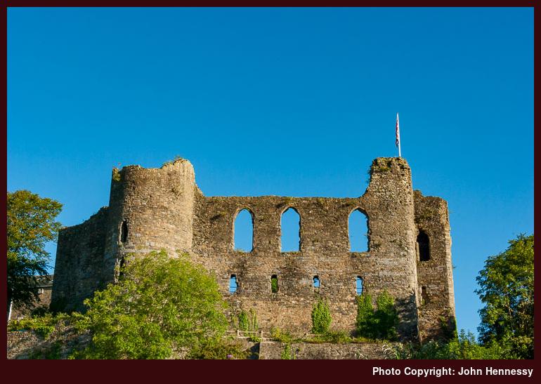
While all the above threw up appealing options, I decided to trim my cloth to my measure to settle on a hike from Strumble Head to Fishguard and it rewarded me copiously too. Of course, it helped that Sunday morning came sunny after a Saturday with plenty of wet moments. Though its situation is imperfect, Haverfordwest’s castle ruins still caught my eye and became a target for photographic capture before breakfast and prior to my departure for Fishguard. To my mind, the photo above could have been taken in May or June such is the green colour of the surrounding foliage. Maybe the wetness of the year we got meant that the onset of autumn became delayed.
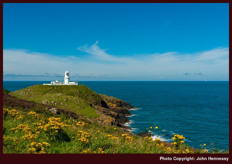
After a little wait, a busy Strumble Shuttle bus conveyed me and others to Strumble Head while others may have gone the whole way to St. David’s, a journey of around two hours along narrow country lanes. This would make good use of a day with suspect weather, but it was that of the glorious variety that I was lucky enough to have. There may have been a white cloud approaching in the distant, but its leisurely approach meant that it was no spoilsport while I was around Strumble Head, though it did end the sunny spell early in the afternoon.
Strumble Head’s lighthouse is on an island called Ynys Meicel and there is a footbridge across to it. However, this was locked so no one could ramble about the spot. Even so, I dropped down to the bridge for a look and took in the sight of the narrow channel that it crossed while a dog started barking; apparently, he took exception to the walking poles attached to my rucksack or so his owner said. Leaving that ostensibly odd situation after me, I decided to make my way south along Carreg Onnen Bay before starting in earnest for Fishguard.
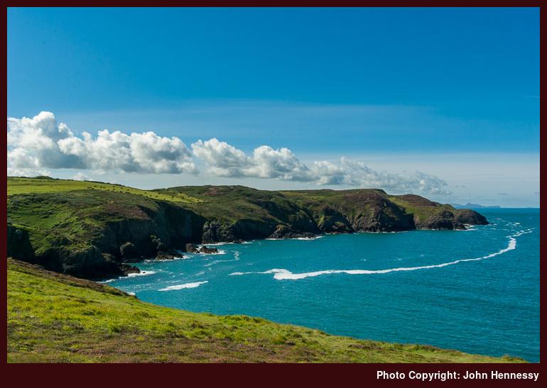
As I looked to the south, I fancied that I could discern Carn Llidi near St. David’s in the distance. There still is nothing that would convince me otherwise unless another visit were to see me proven wrong. As I went south along the joint rote of the Pembrokeshire Coastal Path and the Welsh Coast Path, I lost sight of the more distance view, but there was more than enough to keep me busy in the sunshine. The path was narrow enough and others had the same idea as me, some going slower than others. Going south opens up views of the islands of Carreg Onnen and Ynys Onnen along with keeping that of Ynys Meicel. Those of the coastline by which I was passing were attractive too with their sea-eroded wild ruggedness and there was no trepidation intruding on the proceedings as I did so.
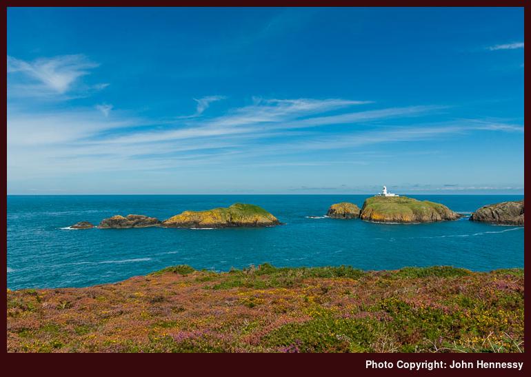
Because I was planning to go in the other direction, I eventually had to find a southern turning point despite how glorious it felt. A piece of higher ground in access land near Carn Melyn did the job for me. It allowed one last panoramic view of what lay around before I retraced my steps. By the time that I reached Strumble Head’s car park again, there had been a change that couldn’t be missed. The approaching bank of white cloud had come much closer and was encroaching on the sun’s space too.
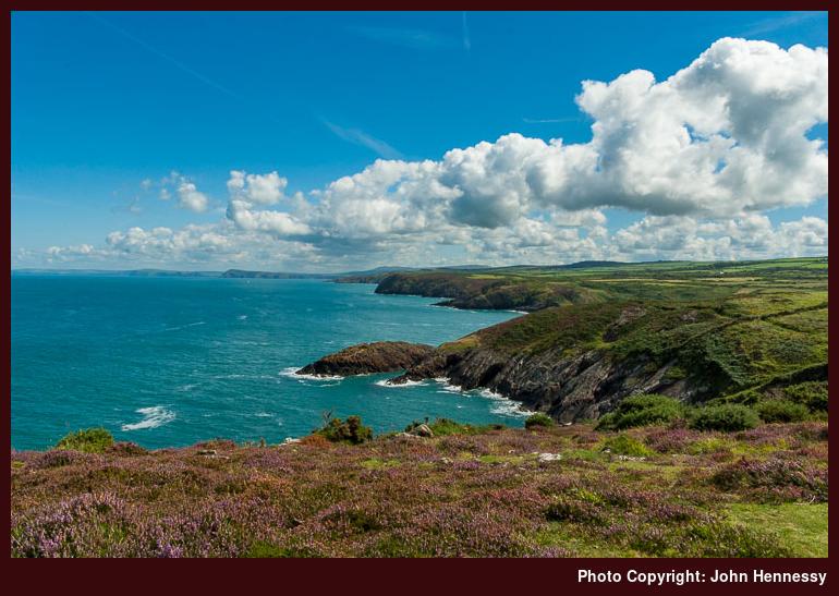
Before there was any more in the way of change, I set to shortening the distance to Fishguard. Given how expansive the eastward views were from there, I stopped for a bit of lunch near Carreg Gybi. Hurrying on ahead of the cloud might seem tempting to me now as I write this but it had no bearing after what I had got from the day by then. As I was stopped, the sights of the likes of Dinas Head and Cemaes Head were within my line of sight, albeit in the far distance.
To reach those far-off places from my location would have taken several days of walking so I was happy to enjoy the views and leave it at that. After all, there was plenty of coastline to pass before I ended up in Fishguard again. Ups and downs lay ahead but they were nothing like what I met between Newgale and St. David’s. There were to be twists and turns too because of the indented coastline but I hadn’t cut myself short on time and was happy to ease myself along. Each inlet was a marker of progress and there were many, many of which with names. Watercourses and muddy stretches were passed too and the civilised world felt further than being a kilometre from a public road would suggest.
There were human intrusions aside from other walkers too. For instance, there was the house near Penryhn and the Carreg Goffa Monument commemorating the ill-fated French landing at Carregwastad Point; rough seas, drunkenness and a wily Welshwoman saw off that foreign invasion. The drop into Cwm Felin and the subsequent rise to sweep around Aber Felin may give clues as to why the landing happened there.
Beyond that site of that historical intrigue, the distance to my destination very clearly was receding. The access land of Ciliau Moor lay in surroundings that felt well isolated even if I were to pass barking dogs just afterwards; they were on the other side of a hedge, thankfully. As my southward turning was approached, I met up with a local man going in the opposite direction who told me about a miniature Giant’s Causeway around Anglas Bay that he found for the first time when he got a little lost while out on a then recent walk, though I never did confirm this for myself; my (southern) Irish accent had given me away as it always does.
Once past Crincoed Point, the breakwater of the Stena ferry harbour was growing in view. Earlier, I had seen the same ship coming and going from there so it would have been much busier than the quiet desolation that I found on my own passing. Before reaching that lower ground, the coastal path was to take me onto tarmac again for the first time since Strumble Head. It would be tempting to think that navigation from there would be a simple matter but, if anything, it was more complex than following the coastal path while away from conurbations. The intricacy was greater than what the map could show so it was up to signage to point out secluded pathways that dropped me from one road to another, taking me near a hotel at one point. Once over the footbridge across the railway, matters became simpler again. Passing the ferry terminal, I made for the tourist information centre to see what food might be served. However, I instead found my way to a useful public convenience and ended up at the local Tesco. My next stop was a seat in a nearby park to partake of an ice cream before going further.
The final stretch of my wandering made use of the coastal tarmacked walkway around Penyraber. It’s a pleasant place to be strolling even without the sun and seeing Fishguard’s older and more sheltered harbour full of pleasure-craft made me wonder what the sight would be like if clouds hadn’t filled the sky as it had. There was a bus to be caught for Haverfordwest and that was playing on my mind too so I didn’t dally. In fact, I timed things just right and had a little wait before it came. When en route, another matter of timing was brought to my attention: there was a rain shower around Wolf’s Castle and hills to its west, so my hiking had stopped before the rain to get a dry day’s walking. The next day came even wetter so thinking about the blue skies and sunshine was at odds with the soaking I got on the way to Haverfordwest’s train station. That won’t stop me pondering a return, though.
Travel Arrangements:
Return train journey from Macclesfield to Haverfordwest, changing at Stockport on each way. Return journey on bus service 412 between Haverfordwest and Fishguard. Single journey on Strumble Shuttle (bus service 404) as far as Strumble Head.
A return to Gower
30th December 2012The last weekend of July 2011 (a month of five weekends, incidentally, and each of them were spent away from home too) saw me make my first-ever visit to the Gower in south Wales. Though the sun gamely attempted to break through on occasions, grey skies were the dominant feature of the trip that saw me use the Heart of Wales railway line for part of my return train journey between Macclesfield and Swansea. Even without the sun, the day was a warm one with plenty of folk around too.
However, it was not a full walking trip like others that I undertake. Even so, I trotted out towards Worm’s Head and returned to Rhossili, making a short loop featuring the coast as I did so. Then, I was lured up Rhossili Down towards its trig point before I scotched the brainwave of making another circuit from there in favour of a quicker return to catch a bus back to Swansea again, pondering a return as I did so.
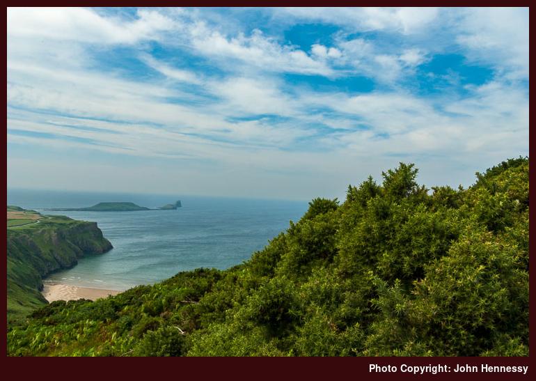
Unlike Pembrokeshire where it took me just over six years to make a return, the Gower was to see me sooner with a visit in early August of this year. Unlike the previous trip, this was a walking outing and there was more sun about too. The hiking started off where I last left off too, with a trot over a windy Rhossili Down that completed the circuit that tempted me before. As I did so, the sun went into hiding on me behind clouds. Even so, there still were better views towards Worm’s Head than in 2011.
Other folk were making the effort to gain height as I was doing so and I played with the idea of avoiding the trig point but revisited it upon reconsideration. From there, it was a matter of picking my way over Sweyne’s Howes and Bessies Meadow before dropping down to Hillend Burrows. Rhossili Down is access land and seems to see a lot of footfall, so there were more paths on the ground than on the OS map, so keeping to the right of way would involve some effort if so desired; there was a strong wind so staying upright was more of a concern.
Once down a steep incline (the Down may be low, but that’s never to say that it isn’t steep-sided as so many are), I picked up a bridleway at Hillend Burrows for returning to Rhossili again. Initially, this went by a caravan park, but that was soon left behind me and boggy sections were set to be found too. In fact, there were none of these on the hilltop so it must have been the shelter that sustained them. The sun began to emerge from the clouds again and the heat of a scorching summer day could be felt; it left me wishing for the cooling buffeting that was my lot up high.
The path was a narrow with deviations from the main track when things got really muddy. Once past the caravan park, I began to build up some pace even with others using the right of way at the same time; the deviations came in handy for this. Once by the Old Rectory, I could see my destination was coming nearer and it was reached in less time than I had grown to expect.
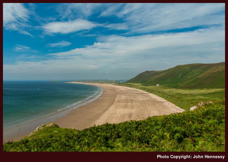
The heat of the afternoon was the cause of my visiting the National Trust shop for some ice cream and a drink. While I was there, some souvenir items for others were purchased too before I sat outside to enjoy the ice cream with views back along Rhossili Bay with Rhossili Down on the right-hand side. Though I stayed a little while, it was later in the day than I had anticipated it would be. A delayed arrival due to traffic congestion and the Rhossili Down circuit perhaps taking longer than expected were contributors to this so I needed to get going again.
Port-Eynon was my next destination and I started by making my way out the busy promontory towards Worm’s Head. The time of day precluded any more serious efforts to make photos of Worm’s Head beyond the hazy ones that I got on the way up Rhossili Down. In fact, it was those views north along Rhossili Bay that yielded the best results for me.
My itinerary was to take me south-east and away from the terminus of the Gower Way. Another development since my last visit to Gower was the instatement of the Welsh Coast Path, though it has been in place long enough for some of the signage to have fallen prey to the elements, so careful use of a map is needed in places too. Some of its course already had been sampled on my Rhossili Down circuit and there was to be more to come. Being along the coast gained me a cooling sea breeze that was strong enough for kite flying and some enthusiasts were making the most of the conditions on offer.
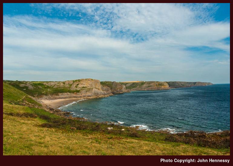
Passing them, I began to see some of the coastal scenery that I was to pass after leaving Worm’s Head behind me. From reading guidebooks, I knew that this was worth walking and it reminded me of that previous visit to Pembrokeshire some years before. Such is the indentation of the coastline that the sights of Rhossili and nearby Middleton weren’t to leave me so quickly. There was a path diversion due to erosion too and recent coastal landslips due to all the rain that we have been seeing make me wonder if more have been needed since then.
In the initial stages, there were a good few folk around, but there was to be more in the way of solitude later on in the walk. Many of these may have been on circular strolls and those can be left behind to go their own way. So, it appeared after passing Fall Bay and doing the same for Mewslade Bay meant an inland deviation and attendant loss and regain of height that reminded me of a hike from Newgale to St. David’s that I did on that Pembrokeshire trip; this yomp was to have less of that, though.
With the last of the undulations behind me, it was onto steady field crossing on the way towards Overton. Cloud had arrived from the west to put an end to the sunshine and gave a sense of close-down to the proceedings as well as a warning of what rain was to come. As I continued in the dullness, there seemed to be more footpath signs than my OS map gave me to expect and I have not been able to see where the paths were leading since then.
In time, field crossing was to be replaced with rocky shoreline walking as the Welsh Coast Path lost height to go under Overton Cliff and along Overton Mere. This section felt wilder and more dramatic than any other part that I had passed all day and would make a worthy excuse for a return sometime; Port-Eynon seemed very away at this point. There was a bell to be heard too and I thought it to be a church bell in that village but I was being deceived. It was but one atop a buoy bobbing out in the sea that could be heard all around. An outsider with easily disturbed slumbering would have some acclimatisation to be doing. That apparent reassurance that I was really near my intended destination had been but a mirage.
In fact, I wasn’t that far away either; one last ascent was to prove that to me. Though I needed to keep going, curiosity had me surveying a monument erected by the Gower Society to commemorate efforts to preserve the surrounding coastline. From there, I then dropped down towards the YHA hostel and trotted across the beach to the roundabout at the Port-Eynon end of the A4118. Following the road from there, I found my bus stop with a few folk waiting there, one of them being a Welshman wearing a kilt!
Having others waiting at the bus stop was comforting because it meant that I hadn’t missed a bus, but the wait was to be a long one that extended into dusk. The earlier traffic congestion that I met on the way to Rhossili was the cause of delaying bus services even more by the time that I was going away again. There even was a call to First Cymru to make sure that buses still were running and it was just as well that I had a mobile that worked in Port-Eynon; O2 and Vodafone didn’t while T-Mobile and Orange did. That bus did arrive before any rain though and that was just as well since thunder and lightning arrived around midnight and stayed for most of an hour in the sultry early hours.
Even with any traffic congestion, the Gower remains alluring for me. Seeing what is around Port-Eynon again with some sunshine would be a good thing and there’s Oxwich Bay and Three Cliffs Bay (the latter’s near Penmaen) to be savoured too. As well as this, catching Worm’s Head at a better time for photography would be another draw and there’s the Gower Way and other parts of the AONB to be experienced too. All in all, there are ample excuses for making a return sometime. Let’s hope one actually happens.
Travel Arrangements:
Return train journey from Macclesfield to Swansea, with a change at Bristol Parkway on the outbound journey and at both Cardiff Central and Birmingham New Street on the return one. Bus service 118 from Swansea to Rhossili and travel on the same service from Port-Eynon to Swansea.
Why go elsewhere when there are good things nearby?
9th October 2012The past few weekends have seen me enjoy walks through local countryside. For instance Sunday saw me drop from the Cat and Fiddle Inn into the Goyt Valley before walking along its length as far as Whaley Bridge. Skies may have filled with cloud as I went and much mud may have been encountered but that reminder from last January while on another walk from the same starting point that landed me in Buxton at its end was set to prove its worth and I wouldn’t mind having another hike around there either.
The Saturday of the previous weekend came up sunny too and I used the afternoon for a walk from Bollington back to my house that took in the Saddle of Kerridge and Tegg’s Nose Country Park as I revisited parts that I should frequent more often than I do. In fact, that was a thought that occupied my thoughts as I took in my surroundings. With so much on my doorstep, I have been wondering why do I not get out there more often.
That may get corrected on the evidence of the Saturday before that again when I followed part of Macclesfield Canal while en route to Lyme Green Retail Park on a shopping errand. A short snippet like that neatly fits into a life with other things that need doing. Little outings often have their uses in getting out of doors to build up to bigger ones and that certainly has been happening over the last few weeks.
During that time, thoughts of wandering around Teesdale from Middleton-in-Teesdale has surfaced more than once only for working week fatigue to put paid to the scheme. The same thing has defeated a trip to Abergavenny to go up and down Sgyrryd Fawr. Another is playing more of a part now as well: local attractions. That’s quite a change given how delights that were further away once blinded me to what lay nearby.
For instance, Sunday offered choices that I struggled to decide between them. One possibility was a walk that took me from the Cat and Fiddle Inn, over Shutlingsloe and then onto home. It was one that would have been my choice but for the sight of cloud advancing from the south. Reprising the Gritstone Trail between Bollington and Disley was another and there’s walking along the Macclesfield Canal between Macclesfield and Congleton in mind too. Then sun shone and decision needed overcoming to get out the door. The Goyt Valley may have got my vote on the day but the others remain tempting though and would make ideal walks for shorter days too.
However, that isn’t to say that walks have been discounted because the list of trip reports that need writing include a range of destinations: Loch Ericht and Glen Tilt in Scotland, Cumbria’s Howgill Fells, the Gower in south Wales and Pembrokeshire in west Wales. Of these, I scarcely have made any mention of those August visits to Wales. The Gower saw me walk from Rhossili to Prot Eynon and its a hike that I can recommend. On a long deserved return to Pembrokeshire, I sampled part of the coastal path between Strumble Head and Fishguard. Cloud may have filled skies on both of these – is that becoming something of a feature for me, I wonder? – but the walking was good and that’s all that I ever ask.
So, I have some sharing to do and more ideas on places to be exploring and revisiting. The shortness of some of my designs should mean that the shorter days of winter should not be an excuse for hibernation. Getting in (at least) one longer walk every month has become my target and it seems to happening so far. It’s a habit that I wish to continue.
Reassembled
11th August 2011After last weekend’s bout of madness on the web hosting side of things, this place is more or less back together again. Along the way, there may have been a lot of poking around backups to get things sorted but there are also were reminders of places where I haven’t been for a while as various entries saw reinstatement. In some cases, I ended up asking myself if it really was that long ago when I last was in some areas. The Brecon Beacons is one such hill wandering destination that hasn’t been savoured for quite a while and Pembrokeshire and Perthshire fall into the same category as does Galloway. Maybe I should poke around here more often whenever I run out of ideas though the likes of TGO should keep replenishing them, especially as I am catching up with a few issues of the magazine at the moment.
These inadvertent reminders have had me recalling how things were when I first started out blogging and how far things have moved since then; those early postings were more pithy and there may a point in returning to a little bit of that, especially if it means that you hear from me more often. There was a lot of talk about motivation and hibernation even in those days and those haven’t gone away though interruptions by work and family life make their intrusions known too. In one respect, seeing what I have already written should stop me repeating myself too often but being confronted by unfinished business is another counterpoint to those occasions when it is too easy to say that I have seen enough of hill country. After you, there always are new sights to see even if it is different light falling on a familiar location.