Jubilees
9th July 2023In Britain, last year saw a public jubilee being celebrated though I took no part in that. This year marks some private ones of my own, but it is the silver jubilee of my own shamblings on the World Wide Web that I have in mind here. Things have come a long way since those tentative steps on the now defunct Geocities. In the meantime, my interests in technology and transportation have found other homes to leave what you find here.
In the dying years of the last century, explorations of the sort that you find shared here only could be a pipe dream. Even photographic efforts were only tentative and involved a compact camera. SLR’s and hillwalking all lay in the future. Explorations of English, Scottish, Welsh and Manx countryside could come only because of what I earned from a working life. These needed time to make them happen too and clement weather to make the experiences desirable.
It is only within the last ten years that I could have entertained notions of international travel that has taken me to various parts of Iceland, Switzerland, Austria, Norway, Sweden, Spain, Canada and France. Even a return to the Channel Islands to follow up on a school trip only happened this year. In the next few weeks, I hope to embark on another international escapade, the details of which I will share later.
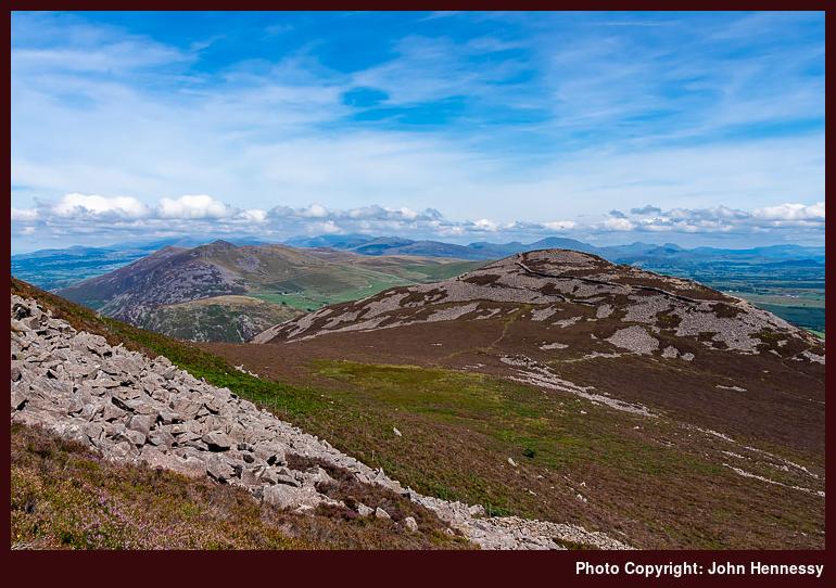
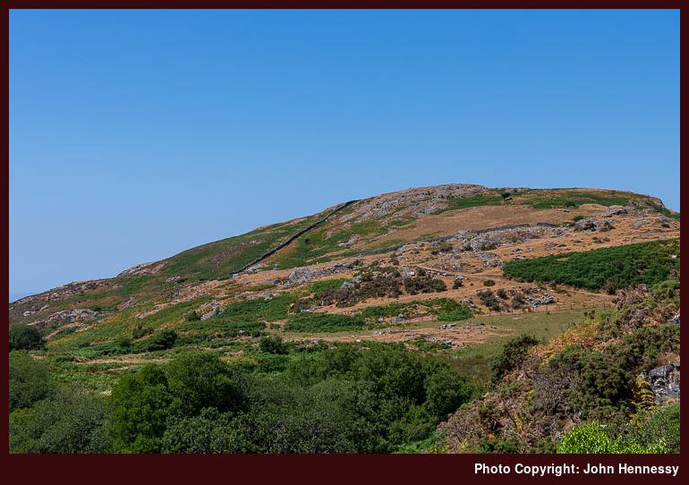
The wanderings continue and photos keep coming. Since Easter, there have trips to Ireland, northwest Wales and highland Scotland. The last of these saw me spend some time around Aviemore taking Craigellachie National Nature Reserve, the top of Bynack Mór, Loch Morlich and Rothiemurchus. A tumble may have ruined a pair of trousers but it pained me to leave the place with a week of sunny weather in train. The Welsh trip had no such drama and featured the top of Y Garn near the Ogwen Valley on a day of gathering heat.
The weather on the Irish trip was mixed, yet there were a few highlights that avoided the razzmatazz surrounding a coronation. A walk from Newcastle West to Abbeyfeale along the Limerick Greenway convinced me that it is best enjoyed as a cycling route. That exertion may have left me feeling the worst for wear, but that did not stop me heading to Clonmel for a circular hike taking in part of the Comeragh Mountains as well as a walk by the River Suir.
The threat of rain did not stop me spending a few hours around Ballybunion or Galway. There was a soaking at the former after a stroll along the Long Strand and a cliff top walk. That was while I was awaiting the bus back to Limerick and I dried on the way back. The day improved in Galway and I got no wetting around Salthill, it somewhat pained me to leave sunny Eyre Square to return from there. Return visits to either place cannot be discounted, even though I have been scathing about the first of these; my parent’s chosen form of enjoyment was not mine, I need to say.
Stories of all the journeying over the decades would have stunned a young university student all those years ago, and there may be more yet. New locations continue to beckon to me and old ones entice return visits. More of those may await and inspire more writing on here afterwards.
An Irish Year
25th December 2022Changes that I am making to matters in Ireland were the cause of my spending a lot of time there this past year. That also meant that I really got to see more of the place than ever before. That was just as well for two reasons. One is that my explorations of Irish hill country have been more limited than I fancied. The other is that the pandemic had grounded me for 2020 and 2021. Being over there a lot allowed me to get more courageous again. There is further to go, but this start was useful compared to where I was earlier in the year.
The nerves applied during various trots starting and ending in Marsden during the spring, so some movement was needed. A day trip to Dublin got me started on flying again. After that, there was a hotel stay in Limerick that allowed me to sample the delights of Adare, the Limerick Greenway, the Lough Derg Way, the Slieve Felim Mountains, Killarney and around Lough Derg. Much of this was in unexpected sunshine, and some was inspired by what I saw from my hotel room as well.
A getaway from jubilee celebrations returned my Ireland. This time, my base was Tralee and I got some wet weather as well. Even so, any sunny interludes got used when other matters allowed. A hike along the Dingle Way from Tralee to Camp was one such beneficiary, as was a circular walk featuring Dingle and Ventry. An amble along part of the North Kerry Way also saw dry weather before something inclement arrived in for the evening time. That affected a second trip to Killarney as much as the presence of a bikers’ festival in the town. The weather also affected a hike from Dingle to Anascaul that might have seen me wander up to the Conor Pass if there were better views up there.
The Lake District got some attention for the first time in some years as well. One trip featured both Lingmoor Fell and Loughrigg Fell on a walk that attended to a photographic need as much as using up an idea that had lain in my mind for a few years. That was followed by a reprise of the Fairfield horseshoe, along with an ascent of Helvellyn. All of these enjoyed warm sunshine that allowed many photos to be made.
The same could be said for the major holiday trip of the year, for that took me to Ireland again. Killarney and Cork were the bases for this one. The former allowed me to frequent parts that I had not surveyed for nearly thirty years. There was one all-day stroll that took me around Knockreer Park, Ross Island and Muckross Lake. This was followed by a hike from Kenmare to Killarney that used past of the Kerry Way, with a diversion to the top of Torc Mountain. The Kerry Way also had a part to play in a serendipitous walk that took in the Gap of Dunloe, the Black Valley and the Upper Lake. These were followed by trips to Bantry, Whiddy Island, the Knockmealdown Mountains, Kinsale and Cobh as the weather continued to warm.
There was a return to Scotland too, though luck with the weather was such that a return trip is in mind. Staying in Stirling again would allow the Ochil Hills and Ben Ledi to be revisited. That awaits longer hours of daylight and a favourable weather window. The two trips that I have had already whetted my appetite for a part of Scotland that I either overlooked or surveyed twenty years before.
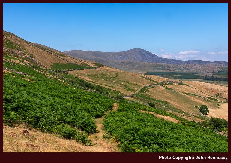
There was one trip to the Welsh hills too. This took me to the Ogwen Valley for a dramatic day that saw me go over Glyder Fach and Glyder Fawr. Eroded slopes were the cause of some adverse comment, but this was a warm, sunny day that offered much. Any plans for descending to Pen y Pass and Llanberis were rejected for time and transportation reasons. Assessing one’s progress often needs a change of route, not that it mattered in this case.
The last Irish trip did not allow more hill wanderings. Time was short, the weather was unfavourable, and other matters needed attention anyway. It was not as if a lot of satisfaction had been given, so I was not put off by this. The temptation might have been unwanted anyway.
The rest of the year saw me grow increasing tired, mostly because of lack of progress with the things that I need to get done. They are spilling into 2023, but that is another year. It remains to be seen how that will go, but trips to Galway and Clare as well as other parts of Europe and North America entice. Only time will tell how things proceed.
A short amble about Yr Eifl
12th December 2022One trip often inspires another, and my visit to the Llŷn Peninsula was another example of this, following on from another to Barmouth. One motivation was to have travelled the entire length of the Cambrian Coast railway line, while another was to visit Yr Eifl after seeing it featured in various magazine route descriptions over the years.
My plan had been to catch a bus from Pwllheli to Llithfaen and walk around Yr Eifl before returning to Pwllheli on foot. That did not happen for various reasons, though indecisiveness on my part affected my traipsing around Yr Eifl.
Firstly, there was the fact that this is a long rail journey so that limited how much time I had available, especially with an arrival time after 13:00 after an early start from Macclesfield. The Sunday timetable was poor for much of the year as well, which meant that weekend stays are not supported as they might be elsewhere. Thus, I wanted to avoid getting marooned.
This was another hot day, and my progress may have been slower than it would have been on a cooler one. Of course, there might have been an element of underestimation in the time needed to get to the main top of Yr Eifl anyway. When this is put together with a fear of getting marooned on a Welsh extremity, cautiousness was bound to intrude.
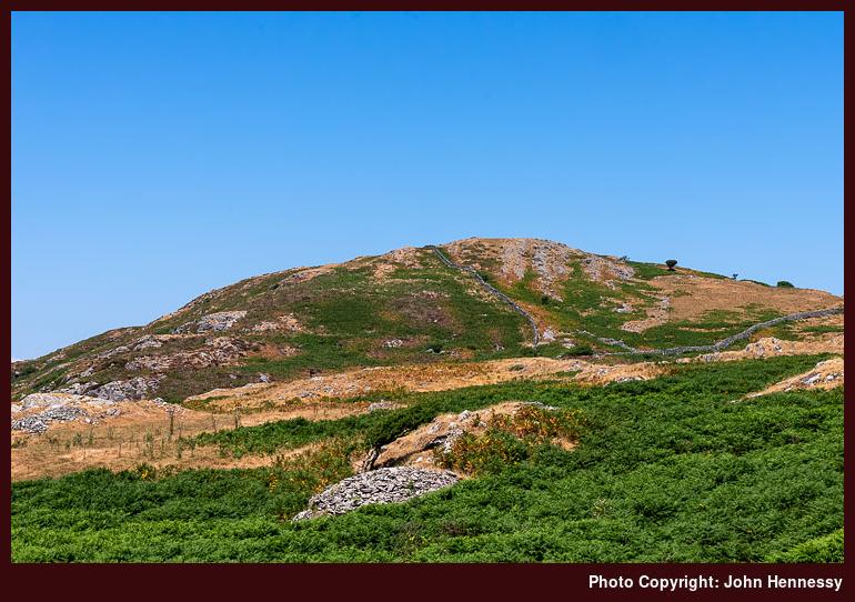
Given the time strictures, I set off out of Llithfaen without delay, not that there was much there to hold me anyway. Its only shop had shut for the day in what felt like a very sleepy place. Thus, this was going to be one of the quieter strolls that I ever have done. It was a case of following the lane by Tynyparc and getting out onto the open hillside, where there are many paths, for this is access land. Rights of way are my normal preference, so I followed one past Caergribin before following a less formal path uphill to the summit with views of Mynydd Carnguwch and Cardigan Bay behind me.
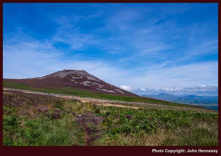
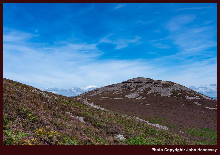
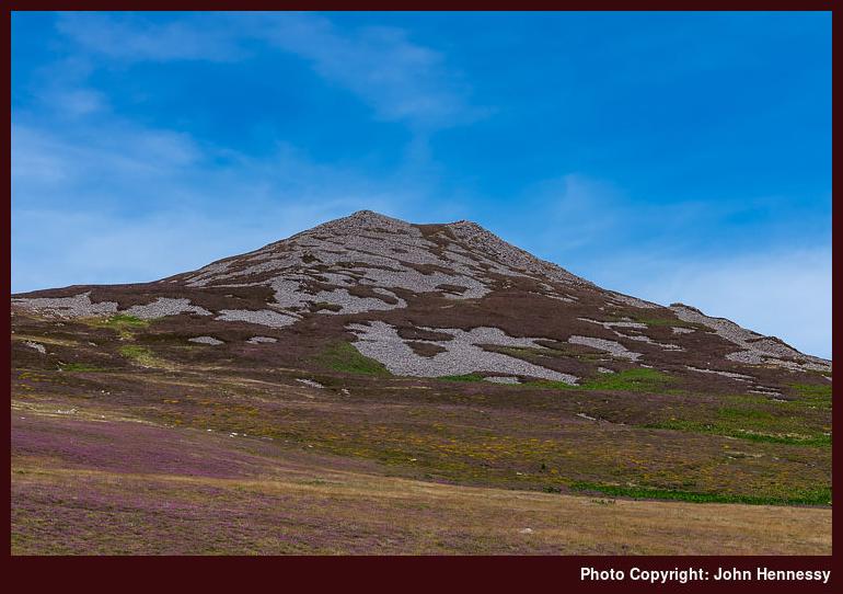
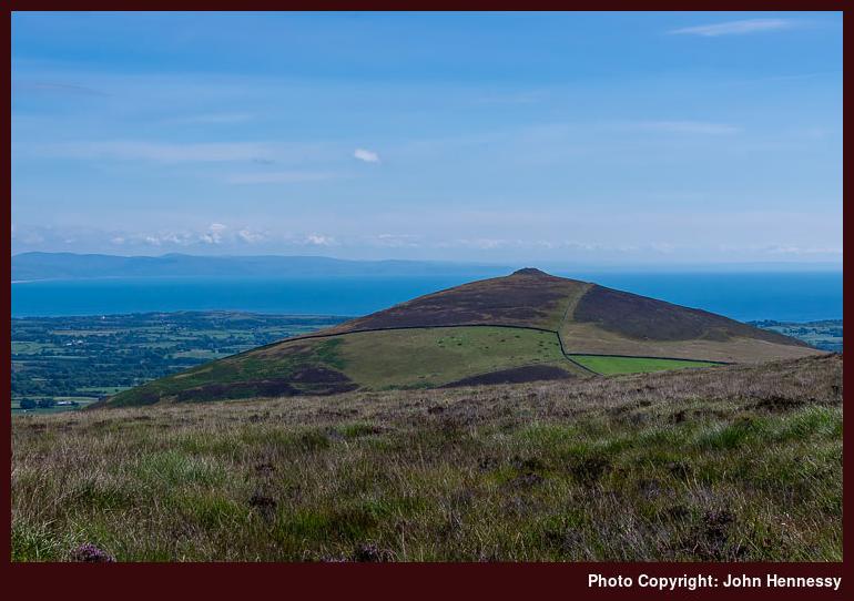
Views of the eastern top of Yr Eifl were to distract me on the way up to the main summit. Even among the stony slopes, walls could be seen on the eastern top. These are the remains of the Tre’r Ceiri Hillfort, a sign that these hills have been frequented by humanity since antiquity. Further to the east, there were other hills to be seen once enough height had been gained. This collection includes Moel-Pen-llechog, Gyrn Ddu, Gyrn Goch and Bwlch Mawr. These take up more land area than where I was and might be worth exploring at some point, assuming a return to the area. The scene was beginning to feel more suggestive of being in more immersive hill country, especially with the hills of Snowdonia in the background.
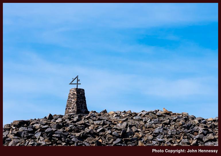
On reaching the main summit, I was greeted by a trig point with the number four added to the top. The letters A and H were added as well, so I wondered if they were the initials of whoever did this. The drop to the sea on the other side is sobering, yet it has not escaped quarrying. Thankfully, I do not recall seeing much in the way of gouges into the landscape, but that might be a different story if I was following the Wales Coast Path, since that gets closer to these active and inactive workings.
My next moves were the subject of some internal debate given time constraints. Visiting the old ramparts of Tre’r Ceiri might have been a no-brainer if it were not for other considerations. Whether I had yet to reject the idea of walking back to Pwllheli or not remains an open question for me now, but I descended to the B4417 in any case. After that, I walked back to Llithfaen again. Traffic was light, and I do know that my mind was set on caution because I caught the next bus back to Pwllheli with time to spare before the next train.
That train was delayed, so I got to spend more time in Pwllheli than I had expected. The delay was heavy, so there was a real risk of missing my connection at Wolverhampton, but I got home that night anyway. Timing concerns mean that it was not the most relaxing of journeys, even with some bright evening sunshine to distract me. The trouble with this section of the British rail network is that much of it is single-track. Thus, a delay to one train can affect others, so there can be all sorts of knock-on effects. In this case, it might have been a passenger falling ill that was the cause of all the trouble. At least, that is what I seem to remember being told when I tried to claim compensation using the Delay Repay scheme.
Even among any qualms, I still began to muse a little over future possibilities. The idea of using Porthmadog as a base appealed to me, possibly because bus connections could address the lack of trains for returning after a weekend getaway. However, a recent look at the train timetable suggests that the Sunday timetable has improved. If so, spending more time near Pwllheli becomes plausible. What I gained was a brief taste of good things, and there are other possibilities in these parts. The railway also serves several access points for other hill walking routes. A bit of advance planning could yield its rewards.
Travel Arrangements
A return train journey between Macclesfield and Pwllheli, followed by a return bus journey between Pwllheli and Llithfaen.
Combining old ways around Barmouth
11th December 20222022 has turned out to be a very dry year, which probably has helped with my explorations of parts of Ireland. While we could not imagine it at the time, it has come even drier than 2018, a year that then was being compared to 1976. One June evening, when I went around by Sutton Reservoir, I was stunned by how empty it looked. It may have meant that there was no fishing to be had, but that left its banks emptier for strollers like me.
This past summer also had oppressively warm spells. One in July was not only record-breaking, but also oppressive in the extreme for many of us. For others, it was life-threatening, and I was happy to see temperatures cool afterwards. If I was brave enough, this might have been a good time to try camping or bivvying outside somewhere if it was not too hot to walk; it certainly was virtually impossible to work inside. Another spell arrived in August during my holiday in Ireland and got much hotter after I came home, even if temperatures did stay cooler than they were during the July spell.
In the past, I have written that hot weather is not good hiking weather, yet I have gone out walking in higher temperatures. Much of 2018 was warm, sunny and dry until things got wetter at the end of July. Before that, there was a lot of hot weather. Near the start of the month, I headed to Edinburgh for a day spent around Cramond and the city centre. Shady places were well appreciated whenever I passed through them. Normally, I have mixed feelings about tree cover, but they were set aside in the heat.
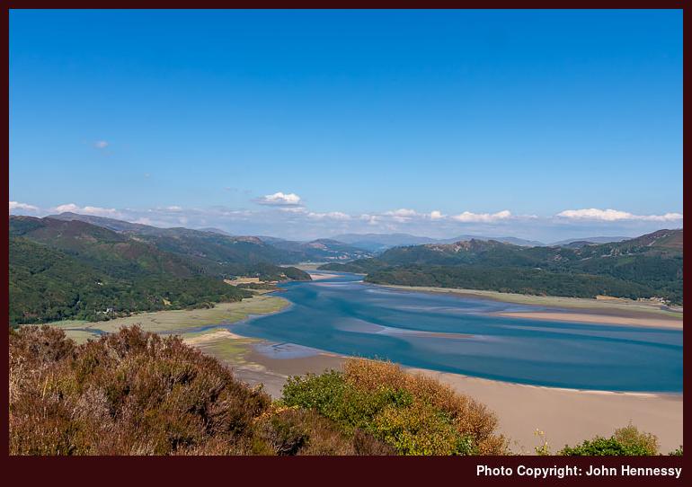
The continuation of the heat did nothing to keep me from heading to Wales more than once. The first of these took me to Barmouth, from where I undertook a circular hike that combined a route that I did in May 2005 with one done in November 2014. You could see from the landscape that the warm, dry weather was taking its toll. Vegetation looked dessicated in places, and heat haze bedevilled any photography.

What I have needed to piece together is my route because it slipped from my memory. Even with photos, this has been challenging to work out, much like the places featured into the photos themselves. This is complex ground, with passes getting names instead of hill tops; you can see what was a priority for the locals in older times. One thing cannot be contested, though: the sea is near at hand and added to any views once the right vantage point was reached.
The Cambrian Way has made it onto modern OS maps, and my early wandering either followed or shadowed it, a major change from the days when publicity was curtailed by worries on the part of mountain rescue volunteers. This was the route that I used to ascend steep slopes before passing Dinas Oleu and Garn. The Cambrian Way was left after me for a while as I went around by Gellfawr, Ffridd y Craig and Bwlch y Llan. This was when the sea views opened up for me, though the hills of the Llŷn peninsula were lost in the haze.
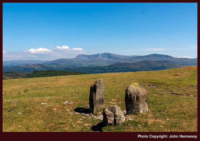
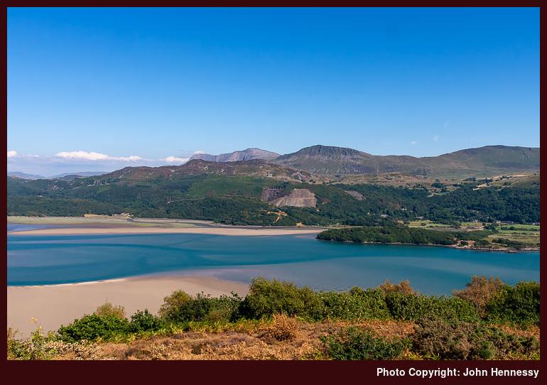
Once over Bwlch y Llan and across the route of the Cambrian Way, different views opened before me. Some of these were just as compromised by heat haze as the aforementioned sea views. That included anything situated to the south of where I was, like Cadair Idris and its immediate surroundings. Other hills like Craig y Grut and Diffwys were not so affected, and also occupied my senses as I made my way towards the Cerrig Arthur Stone Circle. This was something that I wanted to visit again for photographic purposes, even if the time of year and the time of day were not the best for what I wanted to achieve. Another visit in May might not be such a bad idea.
My next staging post was the Panorama walk, and memory haze again affects my recollection of the route. There are a few things that stick for me, though. One was a meeting with overly intrusive dogs around Cutiau, while another was the effect the afternoon was having on my energy levels. At least the shade offered by tree cover helped with avoiding the sun as I continued along the lane, and arrival at the Panorama Walk easily punctuated the way back to Barmouth. There was time to dally in the presence of entrancing views before setting off again.
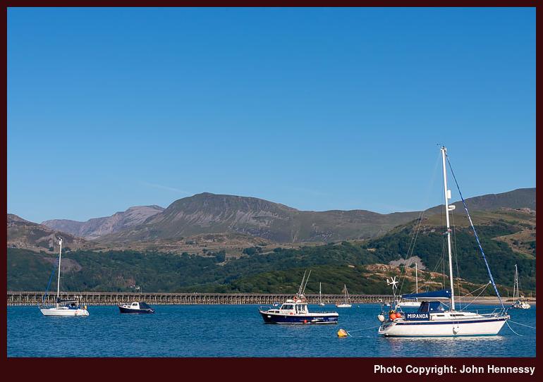
Leaving the environs of the Panorama Walk meant leaving tree cover behind as I went on via Gorllwyn. Barmouth was reached soon enough and with time to spare before my next train. That allowed for some strolling along the shore, taking in views of Barmouth Bridge and what lay beyond it to the east. It was a good end to a walk with its share of tests and delights; there were no regrets.
Travel Arrangements
Return train journey from Macclesfield to Barmouth with a change in Wolverhampton.
A bitter blustery day on Moel Famau
18th April 2021Though there were plenty of things on my mind, like executing my next career moves at the end of a long break, times certainly were simpler in February 2018 than they are now. Personal income was reduced heavily but I also controlled expenditure far better. Also, time largely was my own so I could pop out on day trips whenever the weather allowed, so a sunny day was enough to lure me to Moel Famau, a place on which I had designs for more than a decade. A weekday excursion allowed for better public transport options so the previous stymied trip idea became a real outing.

Ironically, the trip that never happened was inspired by a bus timetable leaflet then produced by the now defunct Cheshire County Council. Instead, I was to encounter other parts of the Clwydian Range on a hike from Denbigh to Ruthin and on another that carried me from Llangollen to Wrexham when Ruthin seemed too far to reach that Sunday evening. Belatedly after those, I was not only to encounter the Clwydian Range but actually potter along part of its length.

My timing also coincided with a school midterm break and Loggerheads Country Park had attracted families, but simply continuing on my way was enough to leave them after me. Given that there were many other spots that granted me more in the way of the solitude that I so relished, that was just as well. To get closer to those, I just followed the River Alyn as it flowed past limestone outcrops and was completely unaware that, behind them, most of the hill of Cefn Mawr was eaten up by a quarry. It just goes to show, that even in Wales, limestone country can hide such a thing.
The full revelation of the extent of scarring left on the landscape by Cefn Mawr Quarry needed some height gain and that was ahead of me if I wanted to reach the top of Moel Famau. Before that though, I remained by the banks of the River Alyn until I left the track to cross the river and some muddy fields to reach Bryn Alyn. There was a road-based route that would have taken me around by Bryn y Castell but I fancied keeping that to a minimum at this stage, possibly a good idea since so much tarmac travel was to occupy the end of the day’s walking.
Nevertheless, continuing uphill from Bryn Ayn on a minor road was needed to get me onto a bridleway that would round Ffrith Mountain and get me most of the way to Moel Famau. As I continued along the track, height was gained all the way and views of the surrounding landscape opened out before me. Much was pastoral and the size of Cefn Mawr Quarry became more and more apparent; most of the hill seemed to be gone!
Leaving sights of environmental sacrilege after me, I rounded the boundary of Clwyd Forest to reach the summit that I was seeking. While the bridleway got me most of the way there, I left it to make the final approach to the Jubilee Tower. As if to remind me of the season, a brief flurry of snow came upon me, but the lasting impression is of the stiff and bitterly cold wind that blew along the ridge.

That did not deter me or the others who were there, but this was not a day for lingering, especially with a wind that could knock you. Still, the tower dating from the reign of Queen Victoria was explored before I started to descend along Offa’s Dyke Path. Conditions underfoot were greasy enough for walking poles to prove unable to halt a muddy tumble. After that, more careful travel was in order, yet my sure-footedness was not guaranteed even then.


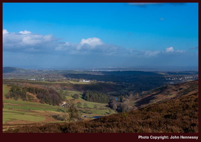
Even with plains abutting the eastern and western edges of the chain of hills, it still was possible to make images that could make one believe that it was more extensive than it was. There was so much scope for that choosing photos for this trip report was an exercise in itself. All the while, the afternoon was edging towards its end so I needed to think about getting to Mold before it got too dark. Before that, I had plenty of moments full of uninterrupted quiet and had ensured that by continuing from Moel Famau to Moel Dywyll after seeing a sizeable group of walkers taking a route that I might have taken. Peaceful wandering was what I sought and there was plenty of that so it often does no harm to let others decide some things for you.
After Moel Dywyll, I found the bridleway that started me on my descent. However, greasy ground turned out to be my undoing as I endured my second muddy stumble of the day. That caused some muttering about my falling into a somewhat carefree mood, but this was the last of these and I continued on my way without anyone seeing my blundering and with added care in spite of the alluring late evening sunshine. The shelter afforded by the valley was all the more appreciated as I passed Garth and two reservoirs on my way to Pentre.
While a side-trip to Cilcain tempted me, weary limbs and declining light informed my decision to follow a stream-side public footpath by Nain Gain instead. After that, it was road walking all the way to Mold’s bus station. Along the way, there was another crossing of the River Ayn and I passed such smaller places as Pontnewydd, Pantymwyn, Gwernaffield and Pant-glas. Light really was fading by then but I got within the street-lighting area in good time and reached the bus station as I hoped, so my journey home started after a satisfying day in the hills laden with soothing quieter moments.
Travel Arrangements
Return train journey between Macclesfield and Chester. Bus service X1 from Chester to Loggerheads where my walk started and, when It ended in Mold, bus service 4 was used to get from there back to Chester train station.